Cheung Po Tsai Cave: how to get there and what it's actually like
In short: Cheung Po Tsai Cave is a natural granite cleft on the south-west corner of Cheung Chau. Its entrance is barely wide enough for one person, there is no light inside, and you go through the rock and come out the other side rather than walking in and turning round. From the ferry pier it is a 2.1 km walk of about 25–30 minutes, or a kaito to Sai Wan pier and a 500 m climb from there. There is no ticket and no gate, and the LCSD’s Cheung Po Chai Cave Picnic Area at the cave mouth is open all day; nothing publishes separate hours for the cave itself — checked 22 November 2026.
| At a glance | |
| Where | South-west corner of Cheung Chau, at the end of Cheung Po Tsai Road, above Chai Tau Wan |
| What it is | A natural cleft in the granite, about 90 m from one mouth to the other and about 10 m deep — not a show cave |
| The entrance | Barely wide enough for one person, entered by a fixed steel ladder |
| Walk from the ferry pier | 2.1 km, about 25–30 minutes |
| Kaito to Sai Wan, then walk | About 500 m from Sai Wan pier, about 6–8 minutes uphill |
| Cost | No ticket and no gate |
| Light inside | None — bring a torch |
Walking from the ferry pier: 2.1 km, 25–30 minutes
Turn right out of the ferry pier and follow the harbour: San Hing Praya Street for 96 m, Praya Street for 80 m, then Tai San Praya Road for 222 m. Leave the waterfront on Chung Hing San Street (146 m) and pick up Sai Wan Road, which runs 919 m west across the waist of the island. Cheung Chau is two hills joined by a narrow isthmus, and this road crosses that waist to the western shore.
At the end of Sai Wan Road the road gives way to footpath. The last 500 m is where the steps are: 229 m of path and a flight of steps, 203 m along Cheung Po Tsai Road, then a 94 m footpath out to the mouth. That end of the walk is the slow part, and it is the part to leave time for.
The boat from Central Pier No. 5 takes 55–60 minutes on the ordinary ferry and 35–40 on the fast one, so a morning on the cave and the west coast fits comfortably inside a day trip — see Cheung Chau ferry times, fares and how to get there.
| Leg | Distance |
| Ferry pier to San Hing Praya Street | 37 m |
| San Hing Praya Street | 96 m |
| Praya Street | 80 m |
| Tai San Praya Road | 222 m |
| Chung Hing San Street | 146 m |
| Sai Wan Road | 919 m |
| Cheung Chau Sai Tai Road | 14 m |
| Footpath and steps to Cheung Po Tsai Road | 229 m |
| Cheung Po Tsai Road | 203 m |
| Footpath to the cave mouth | 94 m |
| Short links at the mouth | 22 m |
| Total, pier to cave | 2,062 m (route length 2,063 m before rounding) |
Allow 25 minutes at a brisk pace and 30 at an ordinary one, which includes the steps. The return is the same 2.1 km, or 1.8 km if you cut back through Sai Wan village to the Sai Wan pier.
Taking the kaito to Sai Wan
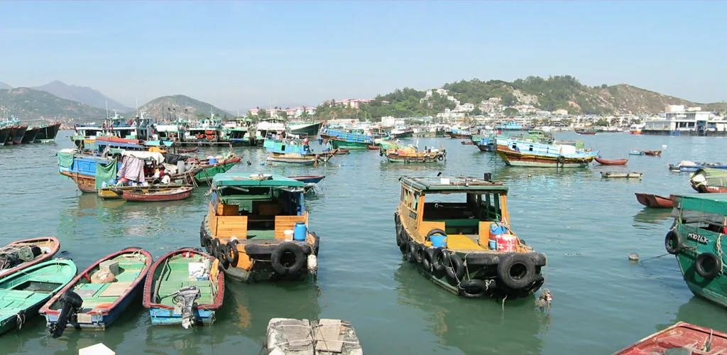
The short way in is the kaito, a small local launch that runs between the Cheung Chau public pier and Sai Wan on the western shore. Leaving the main ferry pier, look for the inner pier with the white canopy roof on the right-hand side and ask for the boat to Sai Wan. It puts you down at the Sai Wan pier about 500 m from the cave — roughly 6–8 minutes of climbing, part of it by steps.
The kaito is not a scheduled ferry: there is no published timetable and no published fare, so you ask at the pier on the day.
Two useful variations come out of this. Take the kaito out and walk back, and you get the cave without the outbound 2.1 km: about 500 m up from Sai Wan pier, then 1.8 km back to the ferry pier through Sai Wan and along the shore. Walk both ways and the cave sits at the end of a 4.1 km round trip from the ferry.
What the entrance is actually like
The Islands District Office describes the entrance as “barely wide enough for one person to pass at a time”, and the government’s Hong Kong Fun in 18 Districts entry adds that it “can only accommodate 1 person and it is completely dark inside”. Both are fair warnings. This is not a cave you stroll into.
You lower yourself into a slot in the rock and down a fixed steel ladder. The passage runs about 90 m through the granite and drops about 10 m, single file the whole way, with no room to pass anyone and no room to turn round. At the far end you climb out through the other mouth. The rock is wet after rain, and the entrance narrowed further when a rock fell in 2012.
What it is not: a show cave with lighting and handrails, or a sea cave you can stand up in. It is a natural cleft between granite blocks, and what people remember afterwards is the squeeze rather than the size.
Safety and what to bring
- A torch. There is no light inside at all. A phone light does the job; a head torch leaves both hands free on the ladder.
- Nothing on your back. A daypack makes a one-person gap much harder to get through. Leave it with whoever is waiting above.
- Grip. Flat-soled sandals and smooth trainers are the wrong shoes for wet granite and a steel ladder.
- One at a time. Go in single file and wait until the person ahead is clear before starting down.
- Children and tight spaces. On 5 November 2026 a child who went into a gap between the rock walls at the cave became wedged and was freed by rescuers after the fire services were called (Hong Kong Commercial Daily, 6 November 2026). A stuck visitor blocks everyone behind. If you dislike enclosed spaces, the rocks above the entrance and the picnic area are the better half of the visit.
- Weather. Rain makes the approach, the ladder and the rock inside slippery. Leave the cave for another day after heavy rain — see our plan for Cheung Chau in heavy rain.
What else is at that end of the island
Sai Wan Tin Hau Temple. The seaside Tin Hau Temple at Sai Wan stands a few minutes’ walk back towards the village from the cave, and it is worth the stop on the way out or back.
The picnic area and viewpoints. A sheltered picnic area and several viewpoints sit about 60 m from the cave mouth, looking over the coast. This is where to sit and eat, and it is the best of the view you get without going underground.
Chai Tau Wan. The bay immediately south of the cave, below the rocks.
The Reclining Rock. The Reclining Rocks (五行石) sit on the coast south of the cave, and the path to them runs about 1.1 km from the cave mouth rather than straight down the shore. Rougher ground than this walk, with flights of steps — a separate outing.
The Mini Great Wall. The Mini Great Wall trail is on the island’s south-east side, about 1.9 km from the cave in a straight line — a separate walk rather than a loop on from this one. See the Cheung Chau Mini Great Wall trail guide.
The legend of Cheung Po Tsai
Cheung Po Tsai was a Qing-dynasty pirate — his name means “Cheung the Kid” — who worked the Pearl River Delta in the early 19th century. The legend attached to this cave is that he used it as a hideout and a treasure stash while evading official pursuit.
The cave is named for the story rather than the story for the cave. No treasure has been reported found in it. It is one of several caves around Hong Kong that carry his name, including another on Lamma, so treat the treasure as the reason the place has a name rather than a thing to look for.
Is it worth the detour?
The cave itself is five minutes of scrambling and a good story. The walk is the bigger part of the outing: 2.1 km each way, or about 500 m up from Sai Wan pier if you take the kaito out. Bank on 90 minutes from the ferry pier and back, including time at the cave.
It earns the trip if the pirate story is why you came, or if you want the quiet half of Cheung Chau — Sai Wan, the temple, the west coast — that most day-trippers never reach. It does not earn it if you have three hours on the island and came for the beach and the food: the walk out and back would eat most of that.
The best version of the day is the kaito out and the walk back: boat to Sai Wan pier, about 500 m up to the cave, back past the temple, then 1.8 km of village and waterfront to the ferry pier.
Related pages
- Cheung Chau sightseeing — the Pak Tai Temple, the rock carvings and the rest of the island’s sights
- Cheung Chau Mini Great Wall trail guide
- Cheung Chau with children — trails, beaches and activities for families
- Cheung Chau hiking
- Cheung Chau ferry times, fares and how to get there
- The inter-island ferry and the kaito to Sai Wan
- Tung Wan Beach
- Cheung Chau map
Walk distances and times are measured on the OpenStreetMap path network and timed at 4–5 km/h including the steps. Ferry times are the Islands District Office’s; the cave’s length and depth are the figures Wikipedia and showcaves.com give it (about 90 m end to end, about 10 m down), not a survey — neither the Islands District Office nor the LCSD publishes one.